
News Summary
As temperatures soar and dry conditions persist, Southern and Central California face growing fire risks. Grasses are drying, heightening concerns for wildfires from Los Angeles to Merced County. Despite a few grass fires, the overall threat of large wildfires remains lower for now. However, with an above-normal fire risk forecasted, residents are urged to remain vigilant. Recent wildfire hazard maps reveal significant expansions in fire hazard zones, particularly in Northern and Southern California, prompting homeowners to take fire prevention measures seriously.
California Grapples with Increased Fire Risk as Hot Weather and Dry Conditions Persist
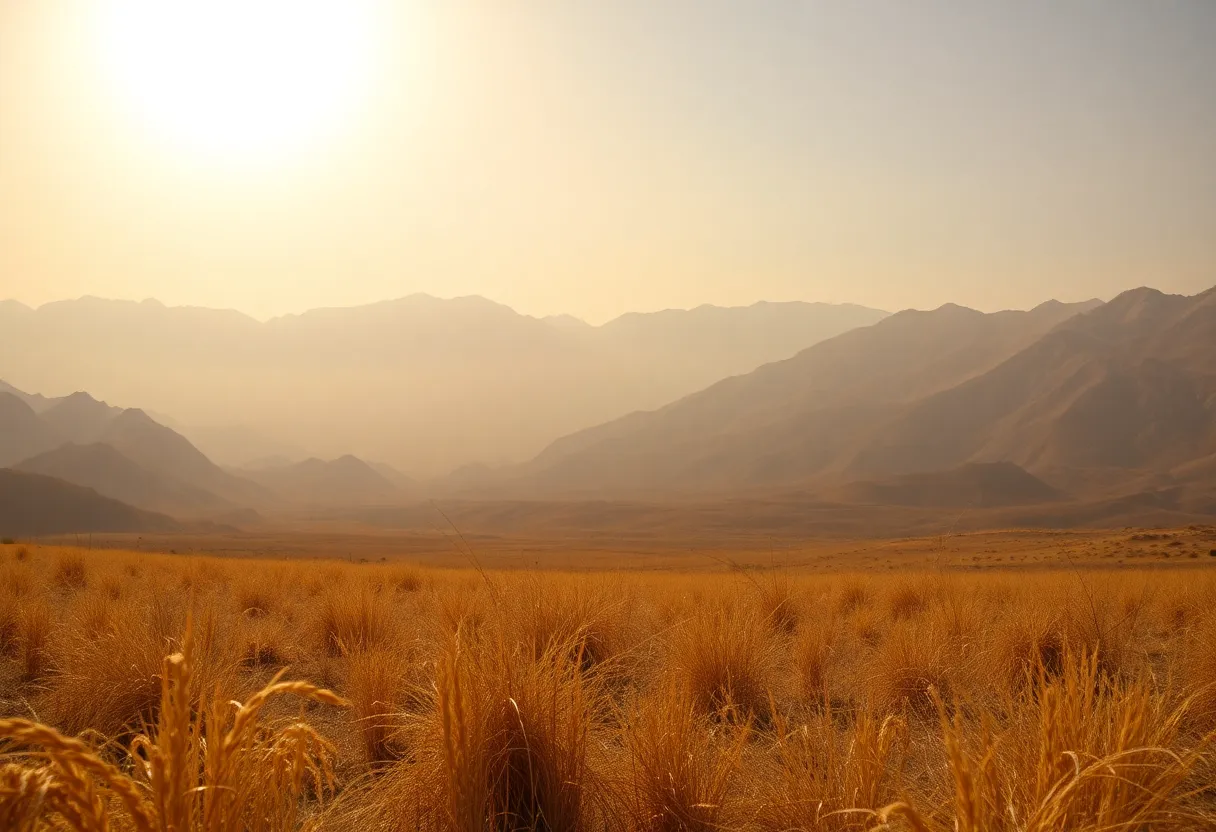
The risk of fires is escalating across Southern and Central California due to increasingly hot weather and disappointing rainfall this season. With temperatures rising and dry conditions persisting, alarms are sounding from the San Fernando Valley to the Sierra foothills in Merced County as grasses that were once green begin to dry out to concerning levels.
Fire behavior analysts are warning that once grasses dry and turn brown, they become much more susceptible to igniting and spreading fires. Recent reports indicate multiple grass fires have broken out in various areas, including Los Angeles, San Bernardino, and Riverside counties. Although these grassy areas typically burn quickly, the overall risk of large-scale destructive fires remains relatively low for now because larger fuels still retain some moisture.
The National Weather Service recently issued and then rescinded a fire weather watch for much of the San Joaquin Valley and the Sierra foothills. This fluctuation reflects the unpredictable fire weather conditions currently being experienced. Hot weather is set to continue throughout California over the next few weeks, with the National Interagency Fire Center predicting an above-normal fire risk for the state this June.
Water Resources and Climate Impact
California’s reservoirs are currently performing well; however, warm and dry spring conditions have accelerated the melting of snowpack, which is a critical water resource. Some watersheds may experience seasonal runoff as low as 70% of average due to below-average spring precipitation, posing potential stress on water resources later in the year. An analysis from the National Integrated Drought Information System confirms that this rapid snowmelt due to increasing temperatures is becoming a widespread issue across the Western United States.
Additionally, a prescribed burn project around the Red Bluff Recreation Area has been postponed due to ongoing elevated fire activity nationwide and anticipated significant fire weather in Southern California. This postponement decision was made to ensure that fire resources remain available for suppression efforts, aimed at protecting life and property.
Increasing Fire Hazard Zones
Cal Fire has recently released new wildfire hazard maps for California, revealing that climate change has led to the expansion of severe fire hazard zones across the state. Currently, there are approximately 6.8 million acres designated as fire hazard zones, marking a significant increase compared to previous assessments. Notably, Northern California has seen substantial increases in these hazard zones, while counties in Southern California, including Los Angeles and Riverside, now encompass extensive areas at heightened risk.
Los Angeles County is particularly concerning, with 314,000 acres classified as “very high hazard,” following destructive fire events in recent years. The new fire hazard maps take into consideration various factors such as topography, fire weather patterns, historical fire incidents, and the type of vegetation present. Homeowners are encouraged to review these updated maps and implement strategies to reduce the fire risk on their properties.
Insurance Implications
While insurance rates may not directly reflect changes due to the new maps, recent wildfires could result in higher costs and reduced coverage availability in areas prone to fire. It is estimated that around 90% of existing homes located in wildfire-prone areas were built before current building standards aimed at fire resistance were established.
The new classifications emphasize that even areas not traditionally recognized as wildland are now at risk for wildfires, particularly due to ember spread from nearby fires. Local and state governments have been given a deadline of 120 days to adopt these new fire hazard maps, with a public comment period anticipated during the review process.
As California faces increasingly dangerous conditions due to hot weather and dry land, awareness and preparation against the backdrop of climate change are critical for residents of fire-prone areas.
Deeper Dive: News & Info About This Topic
- San Francisco Chronicle: Cal Fire Risk Map
- ABC30: California’s New Fire Hazard Maps
- Insurance Insider: Wildfire Risk in California
- Daily News: Southern California Fire Danger Zones
- NBC Los Angeles: New Fire Hazard Maps
- Wikipedia: Wildfires in California
- Google Search: California Wildfire Hazard Maps
- Encyclopedia Britannica: Wildfire
- Google News: California Wildfires


